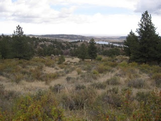
According to my GPS watch, the ride was a mere 3.89 miles, starting altitude was 7307 feet, highest was 7708 feet, so 400 ft climb. Total ascent was 762 feet (not sure how much I trust this since I'm not sure how the GPS accounts for errors in altitude).
Here I am starting up the trail
lots of rocks to climb over. some I had to walk.
a couple of "play areas" to practice climbing over rocks:
nice scenery
just the right amount of challenge:
pretty trees
more pretty scenery
I wanted to do it again, but then came the rain and thunder. oh well, I was lucky, because I started just after a rain storm and got back before the next. The first rain was not that heavy so the trail was not muddy.
This was an awesome ride.


Altitude readings should be good to +/- 75 feet 95 percent of the time (1.5 x horizontal position error) for the basic measurement of position wrt the geocenter. On top of that is the error of the geoid reference that your particular device uses to transform to height above "sea level", which is of similar magnitude or a bit larger. Or so I gather. So, yeah, not so great.
ReplyDeleteHi Marc! So if the GPS is smart, it's algorithm should be able to account for random altitude errors by modeling how the random up and downs accumulate over a given time period. Then it could subtract off this estimate and I would be left with the real up and downs from all the little hills. I suppose I could test this by finding a really flat route and riding on that for a while and see what it gives for total up and down. Next time I'm in Illinois I'll do that. haha.
ReplyDelete